tc3 97 61.pdf
Vista previa de texto
Mountain Terrain, Weather, and Hazards
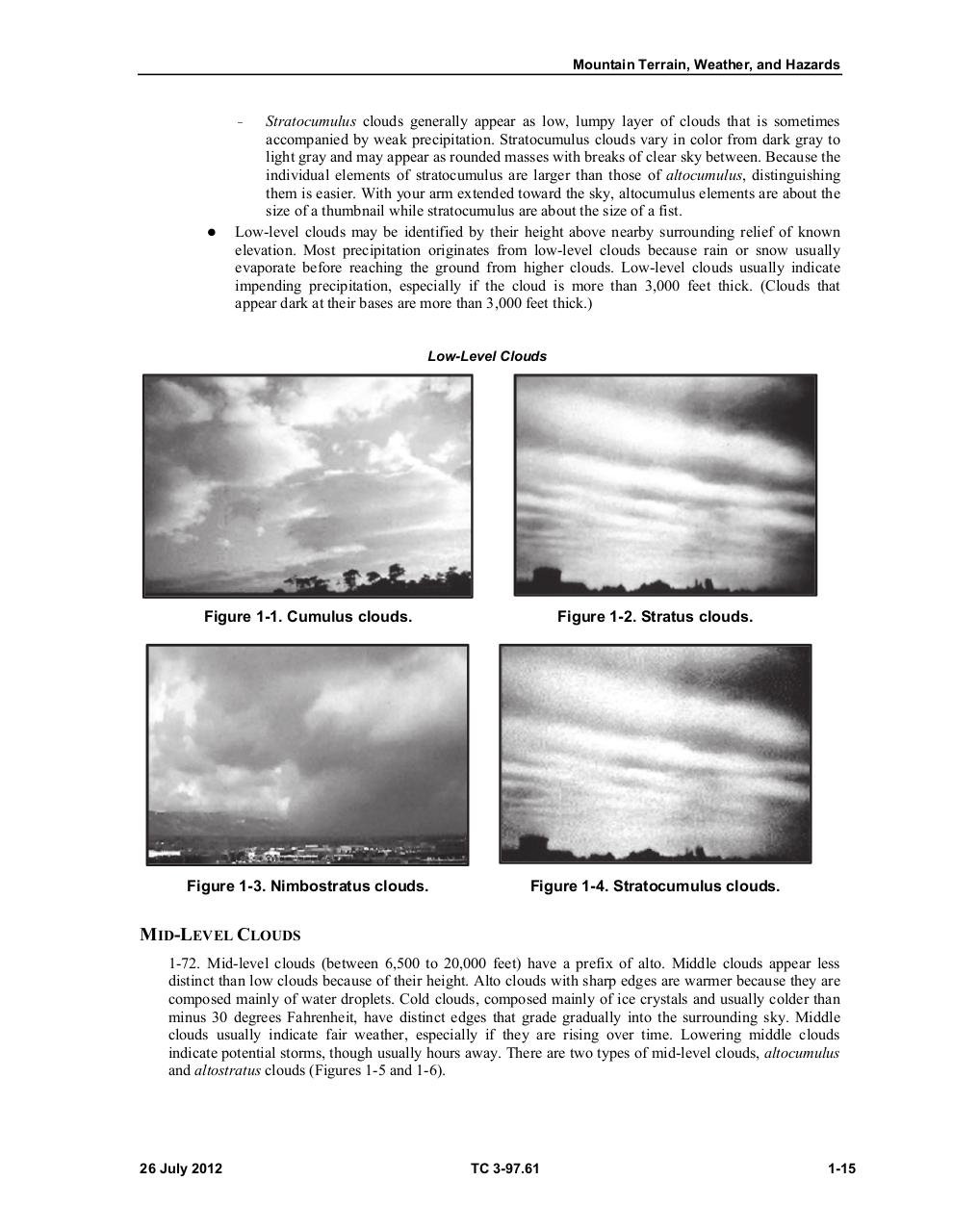
Stratocumulus clouds generally appear as low, lumpy layer of clouds that is sometimes
accompanied by weak precipitation. Stratocumulus clouds vary in color from dark gray to
light gray and may appear as rounded masses with breaks of clear sky between. Because the
individual elements of stratocumulus are larger than those of altocumulus, distinguishing
them is easier. With your arm extended toward the sky, altocumulus elements are about the
size of a thumbnail while stratocumulus are about the size of a fist.
Low-level clouds may be identified by their height above nearby surrounding relief of known
elevation. Most precipitation originates from low-level clouds because rain or snow usually
evaporate before reaching the ground from higher clouds. Low-level clouds usually indicate
impending precipitation, especially if the cloud is more than 3,000 feet thick. (Clouds that
appear dark at their bases are more than 3,000 feet thick.)
—
Low-Level Clouds
Figure 1-1. Cumulus clouds.
Figure 1-2. Stratus clouds.
Figure 1-3. Nimbostratus clouds.
Figure 1-4. Stratocumulus clouds.
MID-LEVEL CLOUDS
1-72. Mid-level clouds (between 6,500 to 20,000 feet) have a prefix of alto. Middle clouds appear less
distinct than low clouds because of their height. Alto clouds with sharp edges are warmer because they are
composed mainly of water droplets. Cold clouds, composed mainly of ice crystals and usually colder than
minus 30 degrees Fahrenheit, have distinct edges that grade gradually into the surrounding sky. Middle
clouds usually indicate fair weather, especially if they are rising over time. Lowering middle clouds
indicate potential storms, though usually hours away. There are two types of mid-level clouds, altocumulus
and altostratus clouds (Figures 1-5 and 1-6).
26 July 2012
TC 3-97.61
1-15